

Research on Subsidence
Dive into a collection of subsidence research
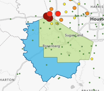
Fort Bend Subsidence District
The Fort Bend Subsidence District ("FBSD") uses exceptional scientific research to ensure the best available technology and approaches are considered with respect to water management and subsidence monitoring. Types of research sponsored by the District include:
- Evaluation of projected population and future water demands
- Development of subsidence models to simulate future subsidence based on projected water demands
- Measurement of annual water-level to show the impact of conversion requirements on the water-level in the aquifer
- Assessment of alternative water supplies including brackish groundwater use and aquifer storage and recovery
FBSD Annual Groundwater Report
The determination of groundwater withdrawal and subsidence in Fort Bend County.
View the 2022 Annual Report
United States Geological Survey
The United States Geological Survey ("USGS") was created by Congress to provide objective and impartial science to support resource managers, emergency response, and the public with information critical for decision-making.
The USGS has conducted studies on subsidence since the 1920s when researchers discovered that aquifers are compressible.
Highlighted Research from the USGS
Water-Level Altitudes
Long-term and short-term water level changes in the Chicot, Evangeline and Jasper Aquifers - Greater Houston Area, Texas - 2022
Hydrogeology and Land-Surface Subsidence
Southeast Texas - 1897-2018
Estimated Land-Surface Subsidence
Harris County, Texas - 1915-17 to 2001
Land Subsidence in the United States
United States - 1999
Ground-Water withdrawals & Land-Surface subsidence
Houston-Galveston, Texas 1906-80
Texas Water Development Board
The Texas Water Development Board ("TWDB") was created to ensure a secure water supply for the State of Texas. Part of this effort includes collection and distribution of water-related data.
Highlighted Research from the TWDB
Land-Surface Subsidence
Houston-Galveston Region, Texas 1977
Analog Model Study of Ground Water
Houston, Texas - 1965
Pumpage of Ground Water and Fluctuation of Water Levels
Houston, Baytown and La Porte, Texas - 1957-61
Pumpage of Ground Water and Fluctuations of Water Levels
Houston and Baytown-La Porte, Texas - 1955-57
Pumpage of Ground Water and Decline of Artesian Pressure
Houston, Texas - 1951 and 1952